What is a time zone? Simply put, it is a way for different places to have different times on their clocks at the same instant. For instance, right now, in India, it may be 6 PM. While in Washington DC, it is 8.30 AM. This is because India is 14.5 hours ahead of Washington in time zones, so to get US time, add 14.5 hours to Indian time. But why do we do this, and why not just simplify everything to get a common time?
We know that the Earth is round. And when there is night at one part of the Earth, it is day time at the opposite side. So if we were to have a common time, say 10 PM, one area would have the afternoon sun at that time, while another might have a sunset. Another might be at the breaking dawn of twilight. Thus generalisations like ‘The sun sets at 5.30 PM’, or ‘Noon is at 12 PM’ will be meaningless. The time zone system is a way to ensure that the phenomenon of sunrise, sunset, evenings and mornings correlate with a fixed set of clock timings throughout the world.
Longitude-
 http://www.land-navigation.com/latitude-and-longitude.html
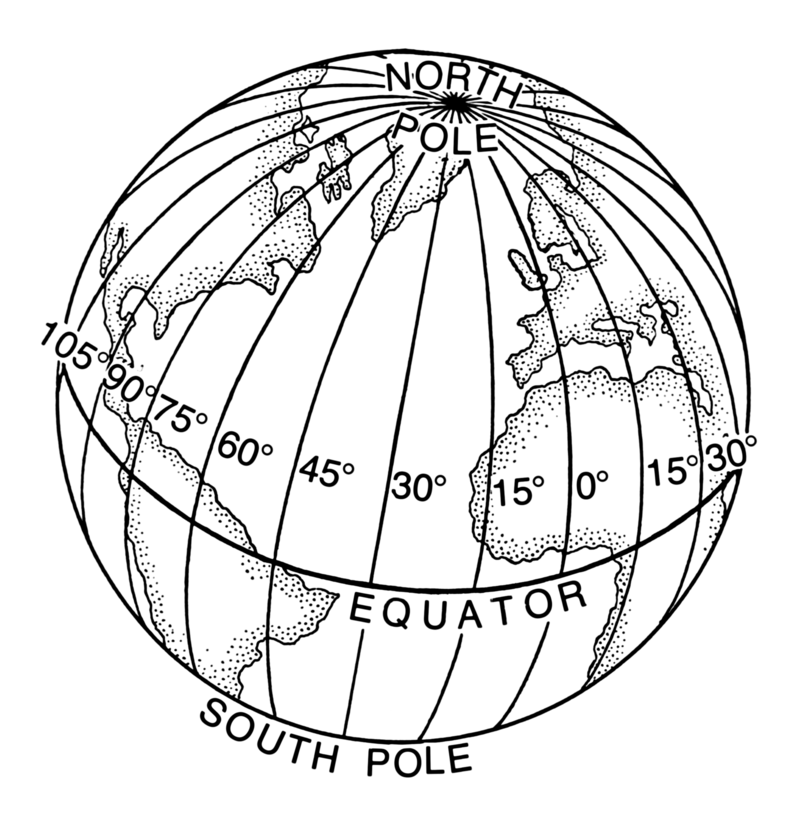
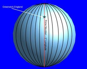
The earth is a sphere. On it, we can draw infinitely many equal length lines from North Pole to South Pole. Each of them are identical to each other, and equally long. We call them longitudes.
For simplicity, we chose a fixed location (called Greenwich), and the hypothetical such longitude passing through that is called the Prime meridian. The time zone here is default, and called GMT. Other time zones are defined with respect to it. GMT +5 means that that time zone is 5 hours ahead of GMT. If the time in the UK is 12 PM, in that zone it would be 5 PM.
We define some other critical meridians. Since there are 360 degrees in a round earth, and 24 hours, so after 360/24 = 15° of meridian change, we expect an hour difference, So there are 24 meridians, spaced at 15° apart, and going from one meridian to the other gives a lag/rise of 1 hour.
 https://en.wikipedia.org/wiki/Longitude
As we move to the right (Towards Asia), we see that they will see the sun rise before the UK. So when it is time for sunrise in the UK, it may already be noon in India. So for a given time (say 6 AM) in the UK, we might see 12 PM in India. To get the time in India, we would need to ADD hours to UK time. Hence as we go to India, the time will be GMT + something.
Similarly, as we go towards the US side, the time will be GMT – something.
Intra country deviations-
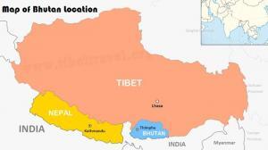
Usually, a country adopts the time zone of a longitude lying close to it. Say if a country is small, like Bhutan, it won’t make sense for multiple time zones within it.
 https://www.tibettravel.org/bhutan-tour/bhutan-location-on-map.html
Even if a common time zone is adopted, the right side may be just 10 min ahead of the left one. So to prevent unnecessary hassle, a common time zone is adopted throughout the country. India has chosen this method, with the longitude passing through the middle of country being used to decide official time
Many countries are so big that they span a variety of meridians. For example, there are 11 meridians between the leftmost and rightmost point of Russia. So if Russia adopts one time zone, the left side will see sunset a whopping 11 HOURS after the right. Hence the time gaps are huge. So it uses eight time zones. A lot of large countries like US, Canada, Brazil and Australia do the same.
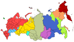 Different time zones of Russia
India had a different quagmire. We were big enough that one longitude is too tough to handle (a gap of 2 hours between leftmost and rightmost edges), but too small to have 3-4 time zones. So we went for the former option. The longitude passing through Mirzapur (yes, the one famous for it’s carpets, and an Amazon Prime TV show!) was deemed the standard for the Indian Standard Time (IST). IST is defined as GMT + 5.30 ie: 5 hours and 30 minutes ahead of GMT.
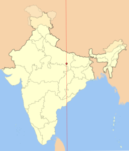 Source- https://www.newworldencyclopedia.org/entry/Indian_Standard_Time
Thus it depends on the country whether it should adopt multiple time zones or a single one. Most countries do the latter, because having a single time zone in the country enhances simplicity and ease of planning operations for the citizens.

